Geospatial Intelligence for Modern Enterprises
Harness the power of data, AI, and geospatial technology to build smarter, more sustainable futures.
Your Trusted Partner in IT & Geospatial Solutions
With over 15 years of experience, Exalogic leads the digital transformation of enterprises through innovative IT and geospatial solutions. We specialize in leveraging AI, GIS, and big data to create intelligent systems that drive meaningful change.

Dr.PG Diwakar
Chief Advisor, Space Research
"Geospatial intelligence is the backbone of smart urban planning, sustainability, and resilience. With AI and GIS, we can visualize the future and build it smarter."
About
A visionary in space applications and geospatial science, Dr. PG Diwakar brings decades of experience to shape data-driven policies and innovation at Exalogic.
Revolutionizing Industries with Advanced Geospatial Solutions

Urban Planning & Smart Cities
Urban Planning & Smart Cities

Utilities & Energy
Utilities & Energy

Transportation & Logistics
Transportation & Logistics

Sustainable Agriculture & Forestry
Sustainable Agriculture & Forestry

Environment Monitoring & Compliance
Environment Monitoring & Compliance

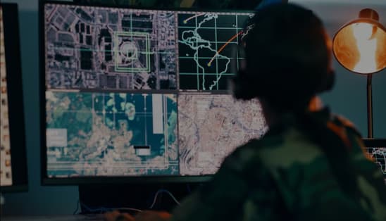
Defense & National Security
Defense & National Security

Real Estate & Construction
Real Estate & Construction

Public Health & Emergency Services
Public Health & Emergency Services
Advanced Geospatial Solutions for a Smarter, Sustainable Future
Urban Planning & Smart Cities
Satellite Imaging for Infrastructure Development:
High-resolution satellite data to support city planning, infrastructure management, and traffic optimization.
Real-Time Environmental Monitoring:
Track air quality, monitor desertification, and assess marine ecosystems, aiding long-term urban development and sustainability.
Environmental & Disaster Management
Climate Resilience through Satellite Data
Leverage satellite data for developing early warning systems for natural disasters like wildfires, floods, and other extreme weather events.
Sustainability Monitoring
Track and analyze environmental parameters to mitigate climate change and ensure sustainable resource management.
Precision Agriculture & Water Management
-
Satellite-Enabled Precision Farming:
Optimize water usage, track soil moisture, and monitor crop health with real-time satellite and IoT technology.
Water Resource Management:
Continuous monitoring of water sources and desalination plant efficiency to ensure sustainable water usage in arid regions.
Space-Based Energy & Sustainability
-
Solar Energy Optimization:
Use solar insolation data to identify optimal sites for solar farm installations and rooftop solar plant development.
Carbon Monitoring & Emissions Tracking:
Employ satellite data to monitor carbon emissions and particulate matter, helping businesses track and reduce their environmental impact.
GeoAI & Big Data Analytics
-
GeoAI-Driven Weather Forecasting:
Utilize GeoAI and machine learning for improved weather predictions and resource management.
Smart Transportation & Logistics:
Develop optimal shipping routes, improve road/rail connectivity, and enhance autonomous vehicle navigation using space-based positioning systems.
Defense & National Security
-
Surveillance & Border Monitoring:
Implement continuous satellite surveillance to enhance national security, border control, and real-time intelligence gathering.
Revolutionizing Industries with Advanced Geospatial Solutions

Specialized Expertise & Strategic Audits
Leverage our deep domain knowledge and consulting proficiency to gain tailored insights, specialized guidance, and comprehensive system audits. We help identify inefficiencies and recommend solutions aligned with your strategic goals.

Standards-Driven, Globally Compliant Solutions
Stay future-ready with our proven expertise in OGC and INSPIRE standards. Our solutions ensure global compliance, enhanced data interoperability, and alignment with the latest geospatial frameworks and best practices

Seamless Technological Integration
Experience the advantage of our technology-agnostic approach. We provide scalable, flexible solutions that integrate effortlessly with your existing infrastructure—removing barriers and enabling cross-platform operability.

Proven Framework & Agile Problem-Solving
Trust in our structured, result-oriented methodology for solution discovery, design, and deployment. We ensure on-time, efficient implementation that delivers measurable impact and long-term sustainability.


We'd love to hear from you!
+ 91 804 101 0727
info@exalogic.co
Our Answers for your doubts
Ready to Transform Your Business with Data driven approach?
Start along the path to a more intelligent and effective company. Contact Exalogic Consulting today for a free consultation and see how our Geospatial solutions can help to scale your business.